
When the next flood arrives: new evidence for integrated streambank repair
Rehabilitated streambanks may look successful while vegetation is establishing and river levels remain low, but the real test comes when the next major flood arrives.
New peer-reviewed research from Alluvium Consulting and the School of Geography, Earth and Atmospheric Science at the University of Melbourne provides compelling evidence that integrated streambank rehabilitation can substantially reduce erosion during these high-flow events.
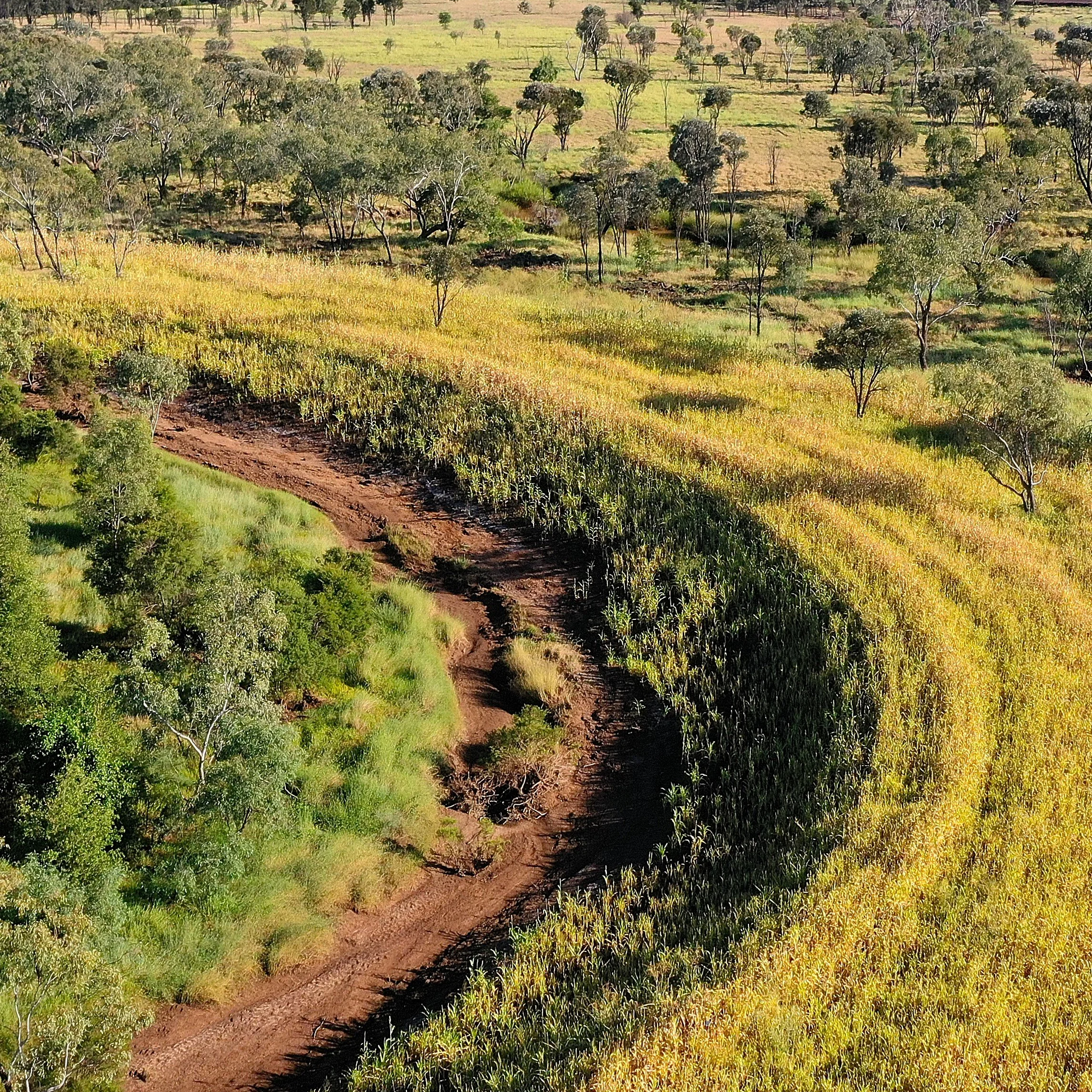
Verterra’s recent rehabilitation of Logan Creek in the Burdekin River catchment (above) demonstrates many of the rehabilitation approaches studied.
Published in Landscape and Ecological Engineering Journal, the study examined a four-kilometre reach of the Mary River near Kenilworth in southeast Queensland. Following a major flood in 2022, the researchers found that treated sections of the river produced approximately 80% less erosion than would have been expected based on the size of the flood and the river’s historic behaviour.
The findings reinforce an important principle of ecological engineering: successful streambank repair rarely comes from planting vegetation or installing a single protective structure. It requires an understanding of how the river and its surrounding ecosystem functions, and a combination of interventions that address the physical causes of instability while creating the conditions needed for natural systems to recover.
Why streambank erosion matters
Erosion is part of the natural movement and evolution of a river. However, land clearing, removal of riparian vegetation, stock access to streambanks, channel modification and activities such as sand and gravel extraction can accelerate streambank erosion well beyond natural rates.
The consequences of this extend well beyond the immediate loss of land.
When a bank collapses, sediment can enter the river and be transported downstream, affecting water quality, aquatic habitat and receiving environments. Fine sediment is of particular concern in Great Barrier Reef catchments because it can travel long distances and increase turbidity, reducing the light available to seagrass and coral ecosystems. It’s also of growing concern in other catchments impacting water quality in the Murray-Darling Basin, Fitzroy River, and many other areas across Australia.
Riverbank erosion is estimated to contribute approximately 30% of the sediment reaching the Great Barrier Reef lagoon from its catchments.
At the Mary River study site, the channel had widened by an estimated 100–200% since the 1950s. Over that period, approximately 1.9 million cubic metres of bank material had been eroded from the reach. Around half of the bank material was fine sediment, with modelling indicating that approximately 66% of the fine sediment generated in the reach could ultimately reach the Great Barrier Reef lagoon.
Addressing accelerated streambank erosion therefore has the potential to deliver benefits at several scales - from protecting productive land and local aquatic habitat to improving water quality across the wider catchment.
Testing streambank repair under flood conditions
Between 2015 and 2021, four actively eroding banks within the Mary River study reach were treated using a combination of bioengineering measures.
The works included:
Reprofiling steep outer banks to improve their physical stability and provide conditions in which vegetation could establish
Installing permeable pile-field groynes to reduce flow velocity and erosive forces near the bank
Applying rock toe protection in selected locations
Revegetating the banks and wider riparian corridor
Controlling weeds
Excluding stock from recovering areas
Approximately 2.5 kilometres of streambank was managed through revegetation, weed control and stock exclusion.
In early 2022, the reach experienced its largest flood since the 1990s. The flood peaked at approximately 3,226 cubic metres per second and was just below a 5% Annual Exceedance Probability event - meaning a flood of that size has approximately a one-in-20 chance of occurring in any given year.
This provided an important opportunity to test whether the works had changed how the banks responded to a major flow event.
80% less erosion than expected
Quantifying the effectiveness of streambank rehabilitation is challenging. A simple comparison of erosion before and after construction can be misleading if the two periods experienced very different rainfall and flood conditions.
The researchers addressed this by using three complementary assessment methods:
A 50-year record of aerial photography to establish the historic relationship between flood magnitude and bank erosion
Before-and-after LiDAR surveys, adjusted to account for differences in river flow
Comparisons with untreated bends upstream and downstream of the rehabilitation sites
The historic record showed a strong relationship between the size of the largest flood in an assessment period and the volume of bank erosion. Based on this relationship, a flood of the size experienced in 2022 would previously have been expected to produce approximately 28,000 cubic metres of erosion per year.
The measured post-rehabilitation erosion rate was approximately 5,000 cubic metres per year - around 80% lower than expected.
The flow-adjusted LiDAR analysis produced similarly strong results. It estimated an 87.1% reduction in sediment production across the wider reach, which included some areas where no stabilisation works or only revegetation had been undertaken. At the four directly treated sites, the estimated reductions ranged from 96.7% to 99.7%.
Upstream and downstream comparison sites did not experience a similar reduction during the same period, providing further evidence that the change within the treated reach was associated with the rehabilitation works.
Why no single intervention provides the answer
Importantly, the study did not attempt to separate the contribution made by each individual treatment. Instead, it evaluated how the interventions performed collectively.
Reprofiling can improve the geotechnical stability of a steep bank, but it may not be enough if high-velocity flows continue to scour its toe. Pile fields and toe protection can reduce these immediate forces, but they do not provide all the ecological functions of a healthy riparian corridor. Meanwhile, revegetation can strengthen banks, increase roughness and restore habitat, but plants need time and suitable soil conditions to establish.
The effectiveness of the Mary River works came from these measures operating as an integrated system – the foundations of an ecological engineering approach.
The individual components reduced erosive forces and protected vulnerable areas during the establishment period; reprofiling created a more stable landform, stock exclusion reduced continued disturbance, and revegetation progressively increased bank resistance and restored riparian function. Over time, the researchers expect established vegetation to become the primary stabilising mechanism as the timber pile fields naturally deteriorate.
This is ecological engineering in practice: using targeted interventions to create the conditions in which natural processes can increasingly support long-term stability and resilience.
Applying these principles at Logan Creek
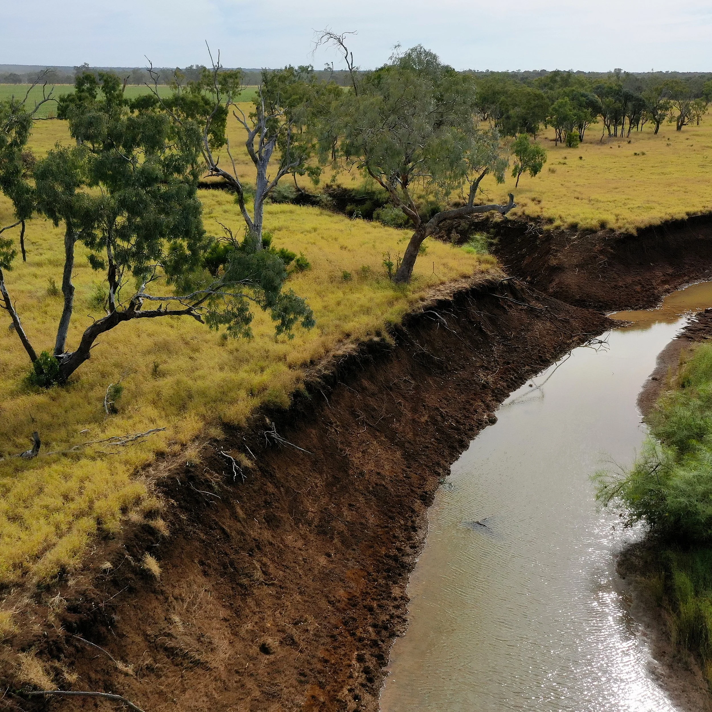
The same integrated thinking informed Verterra’s recent rehabilitation of Logan Creek in Queensland’s Burdekin River catchment.
Extreme rainfall and flooding during the 2021–22 severe weather season caused significant erosion along outer creek bends, collapsing streambanks, removing valuable riparian vegetation and contributing sediment to downstream waterways.
Before developing the rehabilitation approach, Verterra undertook detailed site investigations including drone-based LiDAR surveying, soil sampling and riparian vegetation assessments.
Working with Alluvium Consulting through the Landscape Restoration Partnership, Verterra combined these datasets with geomorphological and landscape-function assessments to develop tailored rehabilitation designs for 13 severely eroded streambanks across three properties.
The resulting works included:
Reshaping and battering unstable streambanks
Installing a grade-control rock chute at a significant erosion hotspot
Treating sodic subsoils using targeted soil amelioration
Revegetating seven hectares of riparian corridor using three native species mixes
Installing salvaged tree root balls at the base of rehabilitated banks to support aquatic habitat
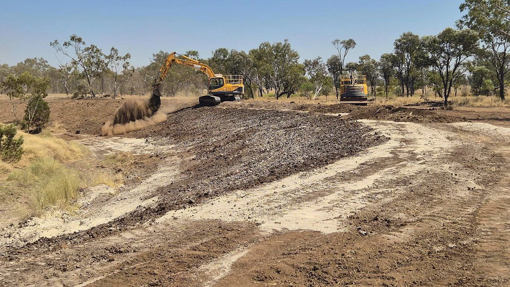
Approximately 11,000 cubic metres of overburden was removed and 930 tonnes of soil ameliorants applied to improve soil structure and support vegetation establishment.
Sediment savings from Logan Creek have not been quantified in the same way as the Mary River study. However, the project demonstrates how the principles supported by the research can be translated into site-specific action: investigate the processes driving erosion, address the physical causes of instability and create the soil, landform and vegetation conditions required for ecological recovery.
From stabilisation to long-term landscape function
Although proved to be successful, the Mary River research does not suggest that the same combination of treatments should be applied to every eroding bank. Rivers differ in their scale, flow conditions, channel geometry, sediment characteristics, surrounding land use and ecological values.
Effective rehabilitation begins by understanding these variables and identifying why a bank is failing. For Verterra, that means bringing together several complementary capabilities:
PROVE: Investigate river processes, erosion mechanisms, soil and sediment conditions, vegetation, baseline condition and sediment risk.
IMPROVE: Design and implement a fit-for-purpose combination of landform reconstruction, flow-management structures, soil treatment, revegetation and land-management controls.
VALUE: Reduce accelerated sediment loss while improving riparian habitat, water quality, land stability and long-term landscape resilience.
The goal is not to prevent natural movement or turn a dynamic river into a fixed channel. It is to address accelerated erosion and help the waterway move towards a more stable, functional and resilient condition.
The new Mary River research provides valuable quantitative evidence that this approach can work - even when tested by a major flood.
The study, “Effectiveness of bioengineered river-bank protection in reducing erosion rates and sediment supply in a Great Barrier Reef catchment, Australia,” was authored by Ian Rutherfurd of the University of Melbourne with Misko Ivezich and James Teague of Alluvium Consulting. It is available through Landscape and Ecological Engineering.